Lidar agents spot Maya ruins faster than they verify them
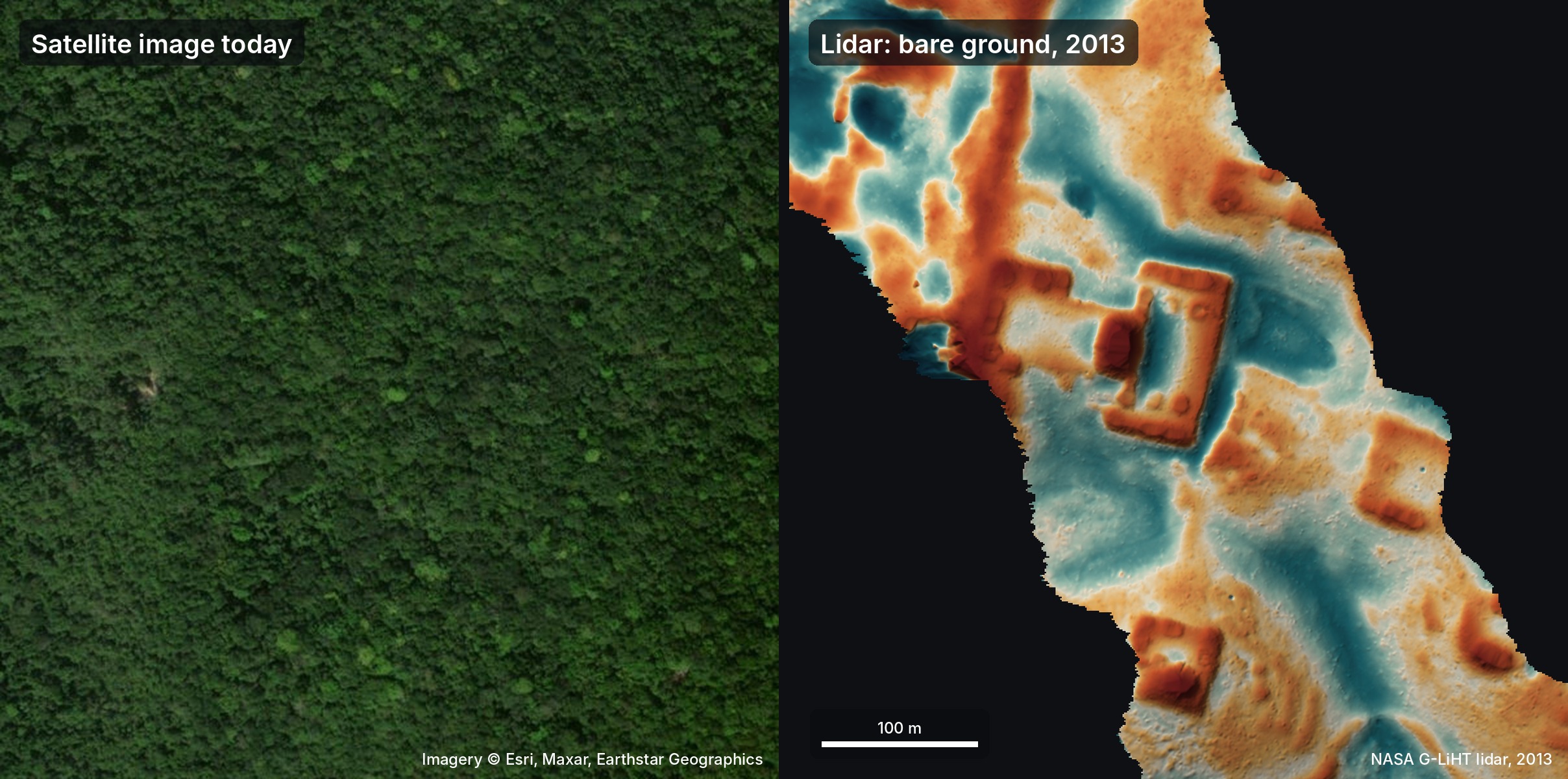
When engineer Pietro Miotti set 48 vision agents loose on 1,200 square kilometers of public NASA lidar data in Mexico, the visual search worked better than anyone had reason to expect. By converting canopy-stripped elevation data into image tiles and giving off-the-shelf multimodal models a prompt describing plazas and pyramids, the fleet flagged genuine archaeological structures under dense jungle overnight. It took less than three days to pull coordinates, extract cross-sections from the raw point clouds, and submit a dossier to Mexico's National Institute of Anthropology and History.
The agents checked academic databases and reported that one prominent hilltop complex had never been mapped. That prompted an official response from Mexican authorities noting no site was recorded in their national register, only for Miotti to discover after publishing that archaeologists had already mapped the exact settlement in a 2025 study. The agents missed the existing paper and treated an incomplete government register as definitive proof of an unrecorded find.
That split captures where agentic tooling actually stands. General-purpose vision models are already capable of brute-force perceptual triage, scanning vast spatial datasets and spotting geometric regularities that human eyes would take weeks to catalog. The failure mode was the literature search. Handing agents the job of surfacing candidate patterns gives enormous leverage, but trusting them to prove a negative across scientific literature is still where the pipeline quietly breaks.